岩手山 Iwate-san Mt. Iwate
|
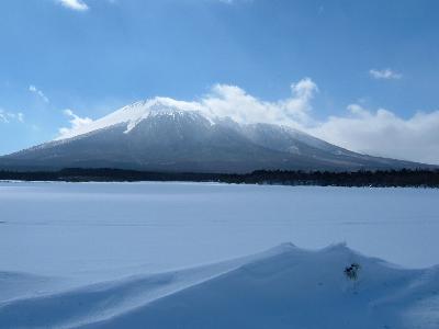
Mt. Iwate with an altitude of 2,038 m above sea level is located in the northern part of Ou mountain range. It is the highest peak in Iwate prefecture. The mountain is a composite volcano with two craters. Located away from other Ou mountains, it may be classified as an independent mountain.
Mt. Iwate viewed from the Morioka side is called “Omote-Iwate (the front Iwate) and the one viewed from Matsuo Village side is called “Ura-Iwate (the back Iwate), which respectively have totally different appearances. The front Iwate has an elegant appearance, while the back Iwate has a rough, forbidding appearance.
As the front Iwate closely resembles Mt. Fuji viewed from Shizuoka prefecture side, it is also called “Nanbu Fuji.” However, as one side of the mountain is deformed by the volcanic activities, it is often called “Nanbu Kata-Fuji (one-sided Fuji).” The mountain is an inactive volcano, which erupted twelve times in the past. The latest eruption occurred in 1719, since when there has been no significant volcanic activities observed.

- address
- Hachimantai, Iwate Prefecture, Japan
- name
- Mt. Iwate