Teizan Canal, 46.6 km in total length, is Japan’s longest canal built along Sendai Bay, connecting the mouth of the Old Kitakami River and the mouth of the Abukuma River. The first section of the canal, which connected Matsushima Bay and the Abukuma River, was constructed in 1597 by the order of Date Masamune. After his death, the extension works were continued. The canal was named after Masamune’s Buddhist name.
Until the end of the 19th century, boats and ships were the main means of transportation in Japan. After the Meiji restoration (1868), Home Minister, Okubo Toshimichi, asked the governors of the 6 prefectures in the Tohoku region about what they most needed. As a result, he concluded that construction of the canal to connect the Kitakami River, the main artery of the region, and the Abukuma River was indispensable for transporting rice. The construction was completed in 1884.
Today, it is used as an agricultural waterway and functions as a part of fishing ports. In the area along the canal from the Nanakita River to the Natori River spreads a fine seaside park, where a beautiful pine grove continues and a cycling road is equipped.
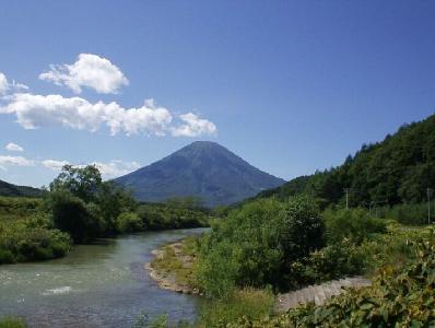
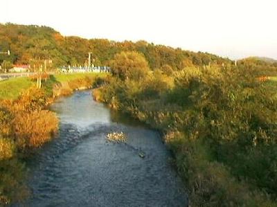
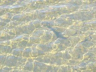
The Shiribetsu River, which flows out of Mt. Fure-dake, runs through the foot of Mt. Yotei and Ran’etsu Town and pours into the Sea of Japan, is a Class-A river with a total length of 126 km and a watershed area of 1,640 sq km. As was certificated as the clearest river in Japan from 1999 to 2002 by the Ministry of Land, Infrastructure, Transport and Tourism, the river boasts its crystal clear water.
A variety of water sport activities are done in this river. As one of the few fine spots for rafting, it is often featured in sport magazines. Some commercial rafting companies provide exciting rafting tours in spring.
The abundant water of this river provides excellent environment for various living organisms as well as agricultural water, power generation and domestic water for the people in the surrounding areas. The watershed area of this river is one of the finest agricultural zones in Hokkaido, where high quality potatoes, asparaguses, Yukihikari rice are harvested. The Shiribetsu River is the blessings of nature and irreplaceable asset of Hokkaido.
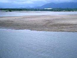
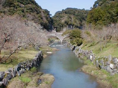
The Manose River is a Class B river flowing out in the western end of Kagoshima City and pouring into East China Sea via Kawanabe Town in Minamikyushu City and Kaseda and Kinpo Towns in Minamisatsuma City. It is 30 km in total length and is the longest river in Satsuma Peninsula.
The upstream area has several places of scenic interest such as the Kawazoe Waterfall and a group of riverbed pit holes. Kinpo Dam is built in the Hase River, a tributary of the Manose River. The area along the river has been known for traditional mechanical dolls operated by the power of water mill, which are called “Suisha-Karakuri.”
The estuary was displaced to the present place by a big flood in the Edo period (1603-1868). The area including the estuary and its adjacent beach, Fukiagehama Beach, which was formed by accumulation of sand brought by the river, is designated as one of 500 Important Wetlands in Japan. Fresh water and sea water flow together in this huge wetland and provide habitat for various species of coastal plants such as Hibiscus hamabo, tidal shore animals such as Uca lactea lactea and wild bird such as Black-faced Spoonbills.
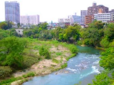
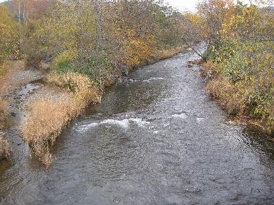
The Hirose River is the largest tributary of the Natori River designated as a “Class A River System” by the Ministry of Land, Infrastructure, Transport and Tourism. The main stream length of the Hirose River is 46 km and its watershed area is about 311 sq. km. The river flows out of the area near Sekiyama Pass in the Ou Mountain Range.
The city of Sendai has developed on the terraced land formed along the Hirose River; hereby the river is called “Mother of Sendai.” The river terrace forming the central part of Sendai City and the natural cliffs typically seen along the Hirose River have been formed in accordance with the changes in the river channel.
The Hirose River provides habitats for a lot of precious flora and fauna including sweetfish and Kajika frogs, which live only in clear water, and over 100 species of wild birds such as common kingfishers and crested kingfishers. Although the Hirose River runs through an urban area, bountiful nature and green woods remain in its watershed area.
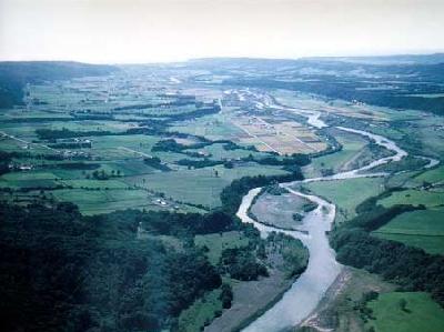
The Shizunai River running through Shin-Hidaka Town in the eastern part of Hokkaido is the representative river in the Hidaka area. Of the 683.4 square kilometer in watershed area and 69.9 kilometer in total length, about 70 % is the mountainous zone in the national forest, where bountiful nature remains intact. The river flows out of Mt. Petegari and Mt. Idonnappu in the Hidaka Mountain Range, where many cirques are found. Surrounded with sheer cliffs, the river has a lot of waterfalls.
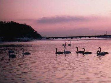
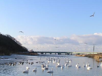
In the old days, the Shizunai River was called the Shibechari River, the name of which derived from the Ainu word “shipe-ichan,” meaning “a spawning place of salmon.” The river is famous as the place where stream gold was panned in the Edo period (1603-1868). It is also known as the wintering place of swans. About 200 Whooper swans come to stay in winter, which is the largest in number among all the rivers in Hokkaido. Also, whistling swans, a very rare species of swan, can be seen in this river, although only a few can be confirmed all over the country in Japan, The Shizunai River was designated as a Wildlife Protection Area in 1965.
The Atsuta River is a 30 km clear stream running through the Atsuta district in Ishikari City, Hokkaido. Flowing out of the Mashike mountains, the watershed areas are blessed with bountiful nature. In the upstream area, a beautiful gorge continues along the gentle stream.
The river is famous for salmon swimming up in the clear water. From September through October, when the leaves of the trees lining the gorge turn red and yellow, you can see a lot of salmon swaying their bodies and swimming near the surface of the river.
The river is also a famous canoeing spot. A lot of people stay at the nearby camping site and come to enjoy canoeing in this river. People enjoy going down the river, while salmon go up the river to produce new life.
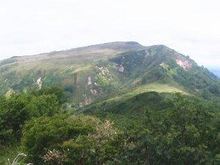
Mt. Pisshiri is located at the southern end of the mountainous region of Teshio in the northwestern Hokkaido. The mountain is selected as one of Hokkaido’s 100 Fine Mountains. It is said that the word “Pisshiri” may have come from the name of the river, which flows out of this mountain and called by the Ainu people as “e pi shiri oma pu,” meaning “a river flows out of a stone mountain.” Mt. Pisshiri with an altitude of 1,032 m is the highest mountain in the northern part of Hokkaido. After passing the 4th station, you will tales the trail along the mountain ridge and can command a fine view of Lake Shumarinai at the foot. The mountain is known for various flowers. You may have a chance to see clusters of Japanese skunk cabbage. The view from the summit is magnificent itself. You can enjoy a 360°panoramic view including the Sea of Japan and the Taisetsu Mountains in the distance. You will revel in luxury nature has provided for you.
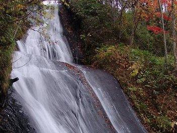
Three-Storied Waterfall (Sandan-no-Taki) is located in Rarumanai Nature Park in Eniwa, Hokkaido, and is the lowest of three waterfalls in the park.
The waterfall is fed by a mountain stream that comes down from Mt Shimamatsu. From the Rarumanai River the water drops 20m down a cliff, whose three steps give the waterfall its name. While not so big, the waterfall carries a high volume of water and appears powerful. This area was originally a valley, so the sound of the waterfall is amplified to give it a greater roar.
You can see the whole waterfall from a nearby bridge but if you want to enjoy a panorama, you should go down to the lowest dry riverbed. At the riverbed, it is true that you cannot see the first step of the falls, but the overwhelming sight is very refreshing. In autumn, the maple leaves redden and you can appreciate a spectacular and gorgeous view.