紋別岳 Monbetsu-dake Mt. Monbetsudake
|
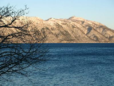
Mt. Monbetsudake (866 m) is located on the outer rim of the caldera containing Lake Shikotsu. It was named so because the Monbetsu River flows out of this mountain. The river name “Monbetsu” comes from “mobetsu,” meaning “a child of a river” in the Ainu language.
This mountain is unique in that the mountain top is used for the radio transmission station of Japan’s major telecommunications company; thereby a number of tall antennas are erected here. They are highly visible from a long distance and function as the symbol of the mountain.
Contrary to its high-tech atmosphere of the summit, it commands a magnificent panoramic view including the Sapporo areas and the Shokanbetsu mountains in the north, the Chitose and Eniwa areas and the Yubari mountains in the east, Mt. Tarumae and Mt. Fuppushidake in the south and Mt. Eniwa in the west.
Mt. Monbetsudake is designated as a Special Wildlife Protection Area by the Hokkaido government.

- address
- Chitose, Hokkaido 066-0000
- name
- Mt. Monbetsudake